

Mulla bho Dheas [Mulla-Fo-Dheas]
Good walks are even better shared.
Overview
Mulla bho Dheas [Mulla-Fo-Dheas]
Mulla bho Dheas stands proudly in the Scottish Highlands, reaching an elevation of 525 meters. This Marilyn offers a delightful walking experience with gentle slopes that make it approachable for hikers of various skill levels.
Geology
The mountain's geology is primarily composed of granite, providing not only a solid footing but also remarkable scenery to behold. The rocks tell an ancient story, having stood strong against the test of time for millions of years. Bring a sense of wonder as you stride through landscapes shaped by eons of natural history.
Routes
Starting from the A82 Road, the ascent spans approximately 6.5 kilometers and generally takes around 2.5 hours to complete. The trail also offers a reasonable challenge with occasional rocky patches and grassy sections. Consider packing a snack for that summit celebration!
Summit Features
At the summit sits a simple yet iconic cairn, a tradition among hikers to honor the peaks they have conquered. The views from the top are nothing short of spectacular; don’t forget your camera to capture the breathtaking panorama.
Terrain
The terrain features a mix of grassy patches and rocky outcrops, along with a fair share of boggy areas, so sturdy waterproof footwear is a must to keep your spirits high and your feet dry!
Views
Once you reach the summit, the scenery unfolds into a tapestry of rolling hills and distant peaks. Spot nearby Mallaig and even, on a clear day, the illustrious Ben Nevis.
Hazards
Keep in mind, the Highlands are notorious for quickly changing weather. It’s always wise to check the forecast and carry an extra layer just in case. Navigate with care through the boggy sections and take caution on rocky areas to prevent any tumbles.
Nearby Summits
Mulla bho Dheas is nestled near several notable peaks including Meall an t-Snaidhm (590m) and Ben Vorlich (985m). Each offers their unique trails and views, making for a rewarding hiking weekend if you're up for the challenge!
Access
Parking can be found in a convenient layby along the A82, with no fees—but do remember to treat that spot like a delicate slice of cake; everyone wants a piece, so don’t hog it. Public transport can be accessed at Crianlarich train station, which is about 7 miles away, with bus routes connecting to the area. Nearby Crianlarich will be your assurer of basic amenities like food and toilets.
Facilities
Facilities are scarce on the mountain itself, but the quaint town of Crianlarich provides a warm welcome with a couple of cafés perfect for pre-walk carbohydrates and hydration.
History
The name Mulla bho Dheas, translating from Gaelic as 'the Hill of the South', provides insights into the Highland traditions. Its ancient paths once served early communities, playing roles in trade and connection.
So, lace up those boots and set forth on your adventure. Whether it's your first hike or another notch in your hiking belt, Mulla bho Dheas has stories to tell and beauty to share!
Explore routes near Mulla bho Dheas [Mulla-Fo-Dheas]
Public walks starting within 80 km of this hill. Nearby does not mean a route reaches the summit; check its map and access before setting out.
Beautiful private beach walk Isle of Harris
View route
Berneray Community Hall to the beautiful beach
View route
Fairy Lochs Liberator Wreckage Circuit
View route
Route planning notes
These notes describe possible approaches, not verified navigable routes or permission to cross land. Check current paths, local access rules and conditions before setting out.
Starting from the A82 Road
A relatively straightforward ascent with gentle slopes and stunning vistas, perfect for those new to hillwalking.
Make a day of it, together
Find someone to share the walk with, or organise a day out along a route you like.
Photo Gallery
View all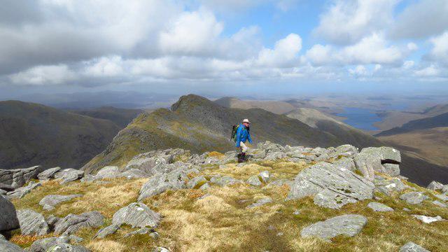 Photo could not load
NB1407 : Approaching summit of Mulla bho Dheas
Colin Park
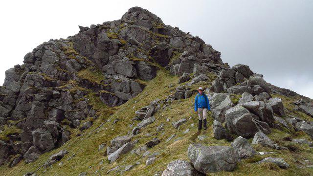 Photo could not load
NB1407 : A steep section of the ridge east of Mulla bho Dheas
Colin Park
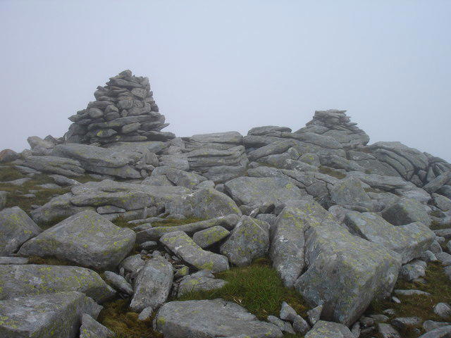 Photo could not load
NB1407 : Cairns on Mulla-Fo Dheas (in the mist)
Kathryn Goodenough
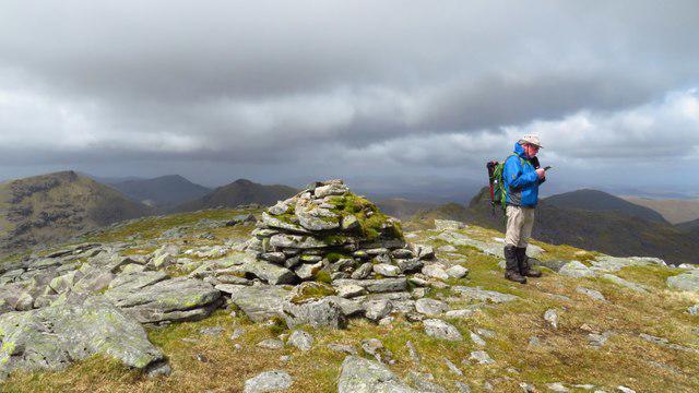 Photo could not load
NB1407 : Summit cairn on Mulla bho Dheas
Colin Park
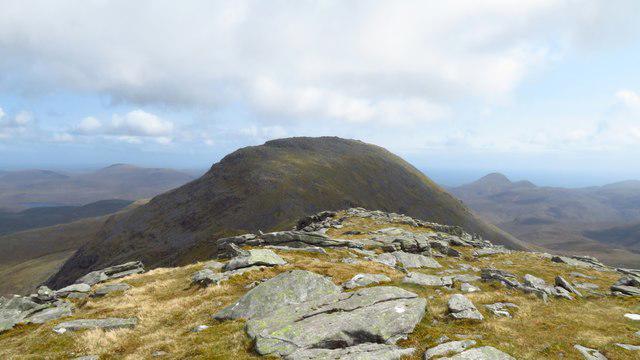 Photo could not load
NB1407 : On summit of Mulla bho Dheas - view towards Clisham
Colin Park
Hill facts and local notes
Classifications
Elevation
743m
2,438 ft
Prominence
138m
Coordinates
57.9658, -6.8326
NB143076
OS Map
13 14
Explorer: 456
At the Summit
The summit features a modest cairn and a stunning panoramic view of the surrounding glens and mountains. It's a perfect spot for lunch and a photograph or three!
Terrain & Geology
The mountain is primarily composed of Granite, contributing to the rugged scenery and diverse landscape. The rock formations are relatively ancient, dating back millions of years, offering a glimpse into the earth's geological past.
Views & Scenery
From the summit, enjoy sweeping views of the surrounding Scottish Highlands, including nearby peaks and picturesque glens. On a clear day, you might spot the distant contour of Ben Nevis.
History & Heritage
Name Origin
Mulla bho Dheas is Gaelic for 'the Hill of the South.' It's said to reflect the mountain's location and orientation within the landscape.
Historical Significance
This area holds historical value with ancient pathways nearby used for trade and travel by the early inhabitants of the Highlands.
Getting There & Facilities
Check current local access restrictions, parking rules and transport timetables before travelling. These notes do not confirm public access to the summit.
Parking
There's a layby on the A82 which offers a convenient parking space. Parking is free, but please be considerate to other road users.
Public Transport
The nearest train station is in Crianlarich, about 7 miles away. Regular bus services operate from there to the nearby A82.
Nearby Facilities
While amenities are minimal at the mountain itself, Crianlarich has a couple of cafes and public toilets to fuel your adventures. Always a relief!
Safety Information
Known Hazards
- Beware of sudden weather changes typical in the Highlands. Keep an eye out for soggy patches and unstable rocks as you traverse.
General Safety Tips
- Check weather conditions before setting out
- Carry appropriate clothing and equipment
- Let someone know your planned route
- Take a map, compass, and GPS device
- Carry emergency supplies: food, water, first aid kit, torch
Hills
Some common questions about the hills answered
Are there group walks up Mulla bho Dheas [Mulla-Fo-Dheas]?
Many walkers use Walkmates to join or organise walks with others. You can check for group walks around Mulla bho Dheas [Mulla-Fo-Dheas] through the maps
Are there other walkers around Mulla bho Dheas [Mulla-Fo-Dheas]?
Activity varies by location and time, but Walkmates lets you see whether others have shared walks or shown interest in this area. Find other people through the walking friends search walking friends for Mulla bho Dheas [Mulla-Fo-Dheas] search or of course create your own walk for Mulla bho Dheas [Mulla-Fo-Dheas]
Can I organise a walk to Mulla bho Dheas [Mulla-Fo-Dheas]?
Yes. If there aren’t any walks listed already, you can create a walk and make it available for others to join.
If you're signed up to Walkmates, you can create a walk to Mulla bho Dheas [Mulla-Fo-Dheas].
How do I find a walk up this hill?
There are often multiple ways to walk this hill, depending on experience and route preference. Walkmates helps you explore walks and routes that others have shared.
Can I suggest a new route up Mulla bho Dheas [Mulla-Fo-Dheas]?
Yes. You can suggest or create routes to share with others. Walkmates focuses on the social side of walking, so routes are used to help people organise walks and explore areas together, rather than as detailed navigation tools or route libraries.
Other uses really appreciate knowledgeable walkers sharing their routes. Share your favourite route to Mulla bho Dheas [Mulla-Fo-Dheas] here
The is an error or something incorrect about this hill. How do I let you know?
We always strive to keep the information on Walkmates as accurate as possible. If you find an error, please let us know through the contact form and we'll aim to correct it as quickly as possible
Community Discussion
Comments
Location
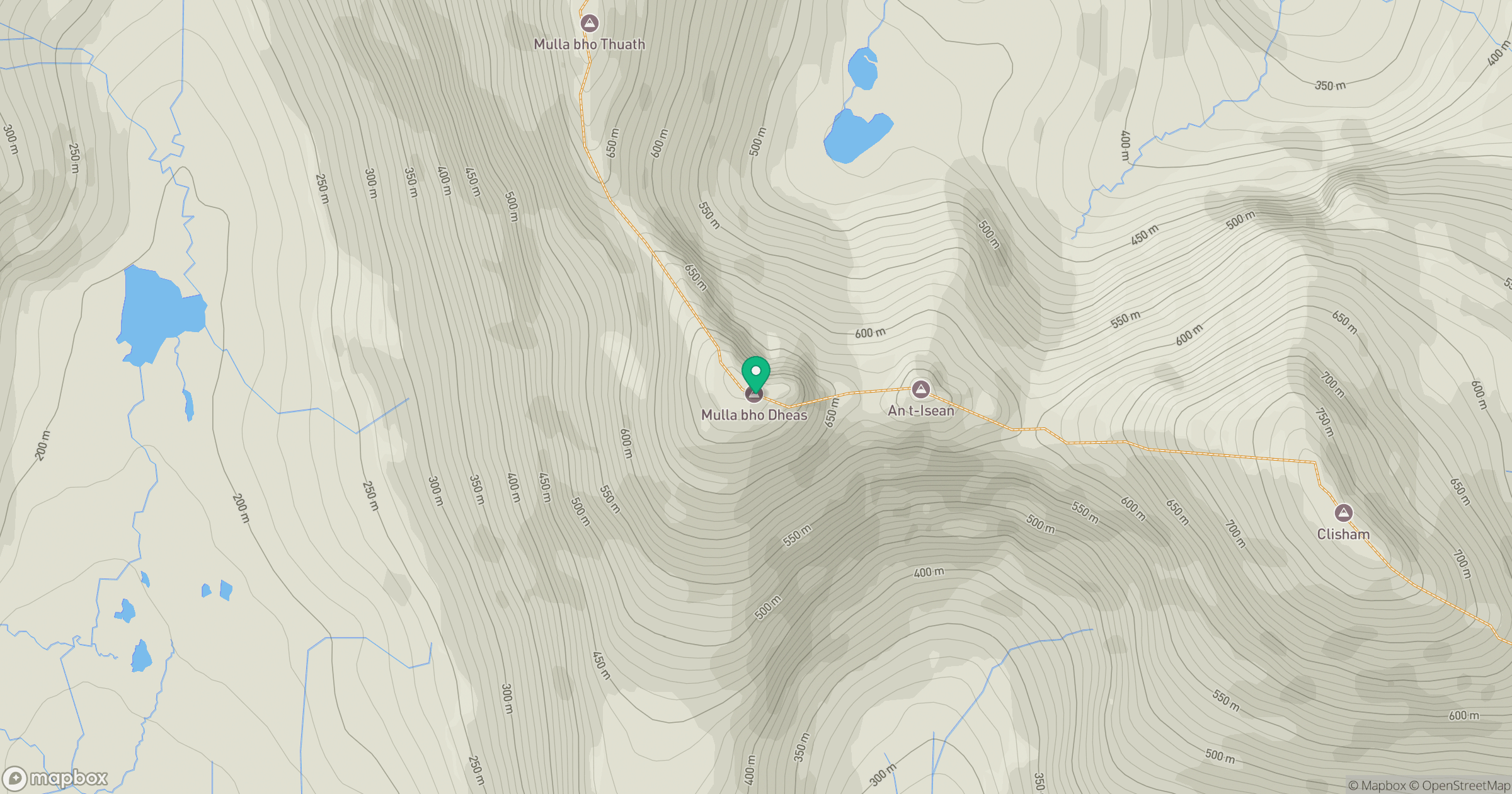
Grid reference: NB143076
View on OpenStreetMapOpens a map in a new tab, centred on the hill.
Hills within 30 km
Straight-line distance, not a walking route or confirmation of access.
An Cliseam [Clisham]
800m
Uisgneabhal Mor [Uisgnaval Mor]
730m
Giolabhal Glas
475m
Sgaoth Aird
559m
Liuthaid
492m
No comments yet. Be the first.